 By: Matt Schumann –
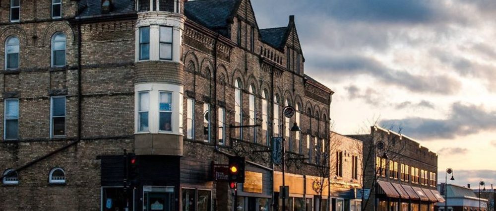
On July 2nd I took a drive west from my apartment in Madison, WI, and headed into the rolling suburbs past the city limits. Throw a rock south of the “Beltline” (Madison’s Hwy 12, 18, & 14 combo that swoops under the city’s southern border running east to west and west to east, depending) … throw a rock and it will basically land in the Driftless Area. Green farmland pops up immediately. Fields of tall grass and rows of ripening corn border right up to dark grey ribbons of well-kept two-lane roads. Every barn and homestead you pass has a nice, newish, well-painted grain silo. Most are of the classic red variety; a few are silver and white. But the majority of good-looking farmhouses and properties have an abandoned, crumbling, or half-smashed barn or barn silo nearby. Not because they forgot to remove it, but as a point of pride and fascination. Each one of these things is their historical marker: A hundred and thirty-year-old stone bases; a corner knocked off by the freak tornado in 1975 … that sort of thing.
It was warm and just past 5 pm and I was in the habit during this time of enjoying the beautiful purple, pink, and orange sunsets. Also, around this time, I was admittedly getting a little stir-crazy and I began searching out places in the outdoors—picnic tables, parks, parking lots—places to use my laptop and its four hours of battery. I found places to connect to free Wi-Fi, which worked well. I did my taxes, on my laptop, in my car, outside Barrique’s Coffee Shop in Middleton; I found a sweet spot in the small park outside the Middleton Public Library; I tried connecting to the web in a southside Madison Panera parking lot. Sadly though, as the night wore on, I must admit that I freaked out the closing manager who (I assume) thought I was casing the restaurant and waiting for him to carry the night-deposit to his car whereby (I assume he assumed) I would rip him off. He and his co-manager kept looking at me worriedly through the front doors while I was, I don’t know, surfing Facebook probably. … Not stalking them, assuredly. I put it all together (their “Panera-noia”) and drove away ashamed. So, I’ll apologize in-person to those guys one of these days. (I love Panera btw … the soup!)
Anyway, the point is: if I’m going to spend gasoline to go for a drive, I’ll try to do multiple things to make it more worth the trip. For example, the drive-thru at Culver’s, then connect to free Wi-Fi somewhere, goof around on the computer while viewing the beautiful sunset. It’s a “three-fer.”
It’s nice to find other people stopping at certain scenic spots and watching the sunset. It reminds me, “Okay, I’m not weird. This is a thing people do.” I believe at this point in the summer, it wasn’t the fault of the California Wildfires that created great sunsets for Wisconsinites. (Sorry Cali, I mean seriously, sorry. I think here I must admit that going out to see an awesome sunset when you know something scary is to blame does, to a degree, include a sliver of, like, rubbernecking an auto accident. “Oh, I heard a volcano erupted in Hawaii. Sad that it destroyed a town. Should be a great sunset!”)
But at this point back in July, it was the worldwide dust cloud from the Sahara Desert swooping over the U.S. that caused the light show. So, I spent a week scouting sunset spots west of Madison. I indeed found the best spot ever, and many other points of interest along the way that would make for a great scenic drive in any season, but in particular, I suspect, it would make for a great fall-colors drive.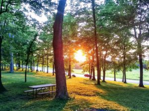 If you leave from Madison, or come in from any direction, set your “Maps App” to Mount Horeb. Highway 18 peels off the Beltline and runs southwest. The signs say this is the Dodgeville Exit, and that’s true, but 18 passes through many cool Driftless Area towns before it gets there. I believe it goes: “Verona, Mount Horeb, Blue Mounds, Barneveld, Ridgeway, and then Dodgeville.” Interesting to note that the middle four towns describe exactly what they are built adjacent to… in their actual names. There is indeed a “Mount.” There are also indeed blue mounds, a “Barneveld” (Get it? Oh yeah.) and, yes, a ridgeway. Visit them all. Buy cheese.
But on July 2nd I drove into Mount Horeb, wriggled through a series of roundabouts, and took a right (north) onto North Washington, which dog-legs into Lake Street. Lake Street does indeed lead to a lake. (I’ll stop saying “indeed” now. Apologies.) Lake Street becomes County Highway JG. After a bend or two JG leads to Stewart Lake. Stewart Lake is only maybe 500 feet wide by a 1000 feet long, but it’s secluded, it’s surrounded by tall trees, and it has a small parking lot, picnic tables, benches, and it sits within Stewart Lake County Park. As I passed, it was hot out, 88 as I recall, and this was an ideal place for a leisurely canoe trip—once or twice around the lake—and a swim in the “swimmin’ hole.” I was tempted. Stewart Lake Park has a new shelter with grilling stands and outlets that would make for a nice reception or party rental. There is a new children’s jungle-gym play area and hiking trails nearby.
County Hwy JG winds through that feature, particularly to the Driftless Area, where you find yourself in a twisty cut with high banks and trees on either side. The road follows Moen Creek which originates up at Stewart Lake and is probably responsible for forming this little coulee. Due to the coziness of the ravine and natural shade, the temperature dropped by several degrees. It’s a phenomenon similar to the dells in the Wisconsin Dells area: striations of sandstone and limestone shelves topped with shady moss. Though you hardly notice it driving here from Madison, Mount Horeb is on a Mount. The four cities mentioned above sit atop a miles wide ridge that gradually narrows to a point (a bit farther past today’s journey) where only the distance of a few city blocks lies between a far-reaching view to the north and a far-reaching view to the south. The fact that you are driving the ins and outs of a high ridge becomes more noticeable as you leave Stewart Lake behind and drop through the valley.
On the right after a few miles is the drive to a homestead—home to the Jangle Soapworks. Jangle is an organic farm that produces Goat’s Milk Soap and other sundries. Their products are for sale in several Mount Horeb gift shops. Though as the 2020 pandemic rearranges Mount Horeb businesses and their hours of operation, Jangle Soapworks and their owner, Janelle Holmstrom, have rolled with the punches. Jangle has a detailed website and product list with pictures of her valley farm and goats. While discussing this with Janelle, I found out that she also is equipped to take gift orders and have them ready for pick-up on a stand at her farmhouse’s front porch, as well as the usual mail-order method. (Think: Christmas.) All of her soaps are made by hand and proudly made with all-natural and locally sourced ingredients that are very assuredly all-natural and not “All Natural” in the way the phrase has been diluted over time to mean just about anything. No artificial scents. Jangle’s soaps and creams are silky smooth with actual silk in some varieties, sumptuous, and all produced with fresh (not powdered) goat’s milk. Check out their site to see the Jangle Soap creation process. “Happy Goats Make Happy Soaps” is their motto.
JG bends and twists around, heading south. It passes an area known as the Tyrol Basin. At the intersection of JG and Bohn Road, there are two attractions nearby. First is the “Terror at Tyrol Haunted Attraction” right off the intersection. Second, a few miles further down Bohn Road is the Tyrol Basin Ski Resort. Wisconsin Ski hills are what they are. We ain’t the Rockies, after all. But for local residents, they do just fine. The hill up Mount Horeb and the other Mounts along the Ridgeway (the full length is known as Military Ridge) are steep enough that the Ski Resort, as well as the Haunted Attraction (!) use chair lifts.
The ski resort, during the summer and fall months, runs a well-kept 18-hole disc-golf course that is open from sun-up to sundown. Checking in with them first to see if the course is rented to a specific party is recommended. They also host an open-for-seating Bar-B-Que themed restaurant open Thursdays and Fridays from 4 to 9 pm. Remember those fall colors are in full bloom this time of year.
The Terror at Tyrol. Goodness. Like many Midwest Halloween spots, the Terror at Tyrol combines elements of fall-colors hiking, natural scenery, hay bail, and corn mazes, and actors dressed as the undead who jump out and go “Boo!” Add in a chairlift and the hike is predominately downhill. They are “On” for the 2020 season, but the in-person scares will be appropriately socially distanced. After a quick phone call with a Tyrol manager, I was assured they are taking appropriate precautions, even though distancing precautions have always been in place – in any era – Covid or not. Actors and “scare-meisters” are not allowed to touch customers and staff keeps customers moving through the attraction with plenty of space between groups. Billed as the Madison and surrounding area’s premier haunted scare-area, their website gets the curious primed for some high-quality frights. They are open every Friday and Saturday in October.
County JG continued and bottomed out in a wooded coulee. There JG ended and I took a turn at a T intersection. I turned west on County ID and lo and behold, I stumbled upon an attraction I wasn’t expecting. Here was “Cave of the Mounds.” Nationally known landmarks. Billboards advertise it for hundreds of miles. I always wondered where this place was. It was getting to be near 7 pm when I arrived, so the park was closed. I pulled over at their drive/entrance. I opened up my laptop and checked out the Cave of the Mounds website. Did I connect to the Cave of the Mounds WiFi? I don’t know. I don’t think so. But maybe! The Cave interior itself probably has pretty crappy WiFi. But there is a gift shop and tourist center. I’m sure they had functioning WiFi.
The Cave people have a pretty nice set-up. There’s plenty of parking for school buses. And they’ve grown and built a large native flower and prairie grass garden with many rock varieties and a functioning sluiceway. This provides a great way to help move and transition elementary school field trippers out of the cave and into the garden; allowing stragglers time to catch up. Or: the reverse. School A from Madison can explore the garden and mining sluice while School B from Janesville works their way through the tour. According to their website, they are open during the pandemic but require reservations and smaller group sizes.
The area around the Cave was a bit more open and the sun was still able to keep the area hot. The 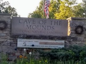 yellow and pink flowers were in bloom and the occasional bee would hop between them.
I left Cave of the Mounds and decided to continue to look for a sunset spot. In July at this time, 8 pm was the target timeframe in which to watch the sun go down. Heading west from the CotM parking lot, I came to an intersection with County Highway F and turned north. Continuing up F, I came straight away to Brigham County Park. This is the spot. I missed the park entrance proper and decided to take the next drive in hopes to connect to the backside of the park. This worked out well, even though I was unable to drive to the park’s main parking area, I drove a short way uphill to a small four-car parking lot that nevertheless was part of Brigham’s gentle hillside and had its own picnic table and grill-stand. This was designated as “parking for shelter two.” Up through the trees of the shaded park, I could see 40 yards away from the main parking area, a stone sheltered area, and the restrooms I need. Much like Stewart Lake, this is a quiet area and I doubt most people know about it other than locals. Behind me in the parking area, through the trees, I could see people—families grilling and people gabbing. There were nice big SUV’s and there was a vintage-looking camper. New school meets old school, no doubt.
After snooping around and reading some signs, Brigham County Park does indeed (whoops) offer year-round camping. The wildlife preserve across the road has hiking and snow-shoe trails. Ebenezer Brigham was a miner and the first permanent (white settler) resident of the area back in the 1830s. If I read Wikipedia right, though, he was also a ranking soldier in the Black Hawk War which, if you know the story, has its tragic history and issues. Brigham is a beautiful, top-of-the-ridge, five-star park nonetheless.
So, as I said, if you are driving up from Cave of the Mounds, on County F, this puts Brigham County Park on your right side. Then as you gently curve along the F-Side face of the park you notice two things: first that, curiously, several park benches are facing the road. They line up one after the other – just four or five of them – with maybe two car-lengths between each, and they are positioned/set a few yards up and back from the actual gravel side of the road: like they’re almost sitting in F’s breakdown-lane. People sit and watch cars go by? No. Because the second thing you notice is on your left. The trees disappear and that side of the road slopes away in a grassy glade that drops to where you see a few treetops and then “Bam” … nothing for miles but Wisconsin farmland and tiny highways to the horizon. Hello, fantastic scenic overlook.
Why the benches? The benches face a huge swath of the Driftless and have a clear view of the sunset. The sun, from this vantage, was going down somewhere over Iowa. Around 8:25 pm as the sun started to drop, people up the hill in the regular park parking stalls made their way past me in my little “shelter two” parking eddy and took up positions at the roadside. A family of four and their little dog claimed one bench. Two women and their big dog claimed another bench. And a group of four college students/hippy kids claimed another bench. This was everybody’s “spot.”
The sun went down pale yellow and changed colors until it was neon pink and then red.
A car driving along the curve of F slowed suddenly and pulled over as though the driver said, “Holy S—t, do you see this?” They got out and leaned against their car and watched. It was one of the best sunsets I’ve ever seen in my life.
Before it got too dark, I drove out of there and continued on F north until it naturally met up with the town of Black Earth. After some back-and-forth and a run through town, State Highway 14 represented itself and led back to Madison.
I can’t wait to go back up there—to Brigham County Park and its overlook of the Blue Mounds Wildlife Area. I check the weather reports for clear or partly cloudy skies. As I write this, Wisconsin is in a week of overcast fall rain. We get these frequently this time of year. I joked with my son today that all of the moisture from the U.S. West Coast is being sucked out of them and dumped on us. “We don’t need it right now! We’re full up. Give it back to them.”
Still, I imagine the sun is setting further and further to the south these days, so to go up there and watch would mean you’d have to sit at an angle and look a little over your left shoulder. Put your left arm up on the back of the bench, as one does. But if you catch it on a clear day in October, you could see a sunset that is so good that the county planted park benches specifically to watch it. And as a bonus, all the trees will be showing their colors too.
Thanks for reading.